The Battle of Crete : 20th May – 1st June 1941
On a trip to Crete in August 2004 I had a chance to visit some of the sites relating to the Battle of Crete. They are presented in the Crete gallery pages. A few maps are reproduced below to try and put some of these photos into context.
A larger version of this panorama is available for download here – large panoramic view (996K).

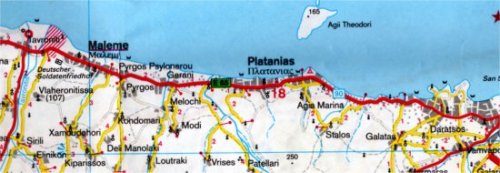
Modern day map of the Maleme – Chania coastline
The map above is not completely up to date – there is now a new main road inland of the coast road, running roughly along the Galatas-Vlaheronitissa line. The map above is not too clear, so again a large downloadable map is available, covering a slightly larger area – map of northwest Crete (692KB).

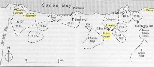
Allied troop dispositions, Maleme – Chania sector, 20 May 1941 (Source: The Oxford Companion to New Zealand Military History and NZHistory.net)

