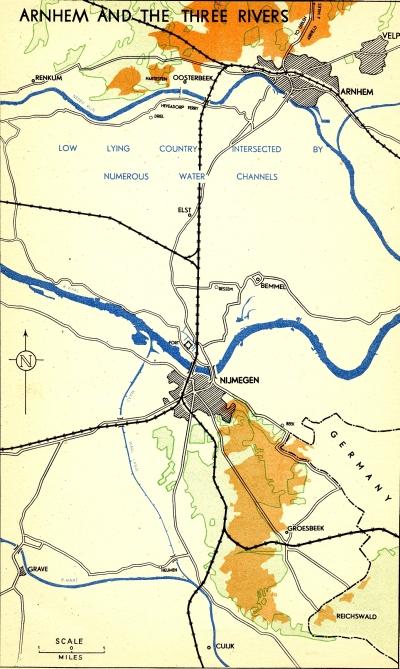
This map shows an overview of the Arnhem and Nijmegen areas
Click on the map for a clearer, higher resolution image
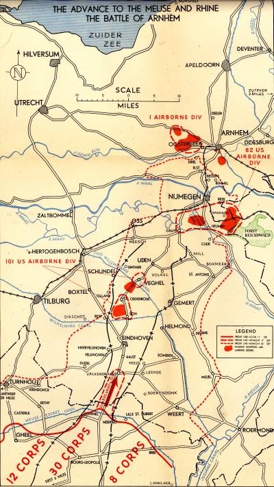
With the details of the Operation Market Plan superimposed on a slightly larger area:
Click on the map for a clearer, higher resolution image
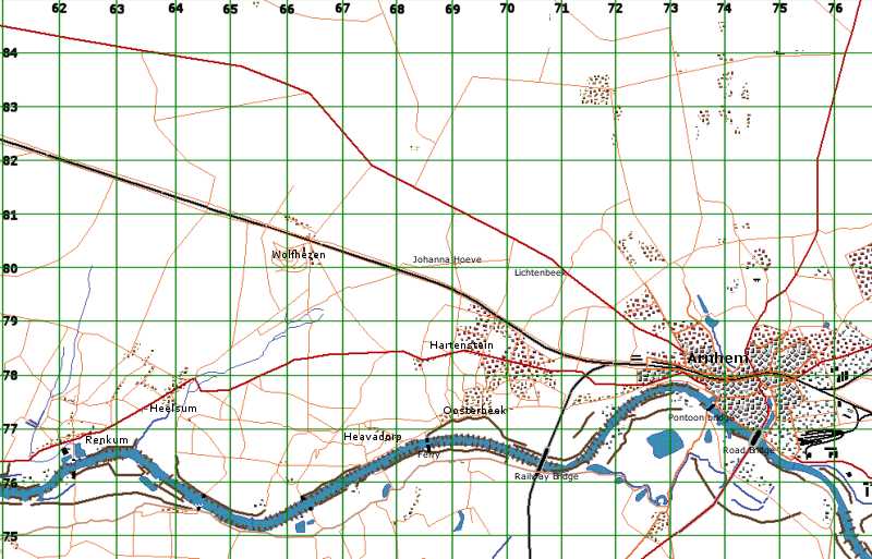
Finally, this map of the Arnhem area shows the location and relative positions of some of the place names mentioned in the source documents, including main routes and built-up areas. More importantly, I have superimposed a grid over the map to provide a reference source for the grid references used in the documents – I’ve given some examples below the map.However, the map is not a direct scan of any World War II period map, and so is not going to be accurate to six figure grid references. It can be used to get a feel for the general area referred to.
Click on the map for a clearer, higher resolution image
Sample grid references in use in source documents
- bridge at 7476 – Arnhem road bridge
- br 7476 – Arnhem road bridge
- ry br 7076 – railway bridge
- br 7377 – pontoon bridge
- hospital 729780 – St. Elizabeth Hospital
- M.D.S. 697784 – Main Dressing Station
- RENKUM area 6276
- HEELSUM 6477
- JOHANNA HOEVE 6980
- LICHTENBEEK 7079
Acknowledgements
The grid used on the map above is based on the 1944 U.S. Army Service map used in John Waddy’s ‘A Tour of the Arnhem Battlefields’. The map itself has been generated using the map editor provided with the excellent computer wargame ‘Airborne Assault: Red Devils over Arnhem’ by Panther Games.


